TerraStride is a mapping technology company that helps people enjoy, manage, and market land.
We enable people to create, share, and publish maps using any device, whether at home or in the field.
Our online mapping platform bridges the gap between mobile and browser-based mapping.
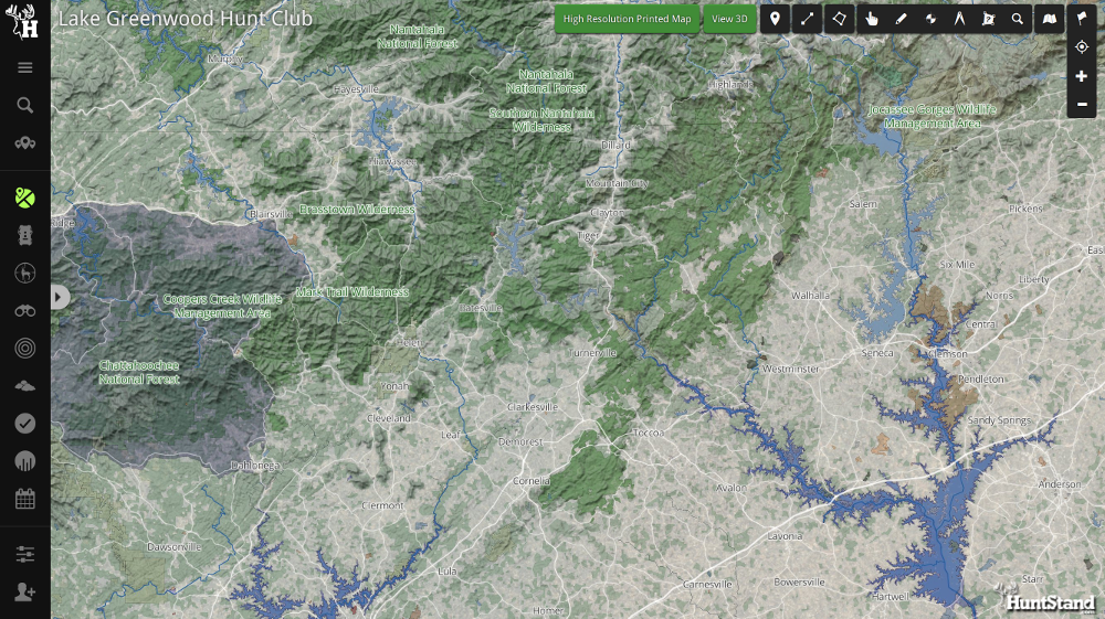
The HuntStand App is a free mapping tool for hunting and land management. HuntStand improves the safety and success of hunters, and provides valuable data about land ownership, designation, and regulation. Users can engage with social features to share maps and collaborate as a group. The app also provides a suite of weather and solunar tools.
The HuntStand app also features our patented HuntZone technology, the most streamlined and efficient way to show wind speed, direction, and changing weather patterns. More details…
Carefully designed to work in both online and offline environments, the HuntStand app provides geospatial, weather, and game data on any device. It enables users to annotate maps of their properties with features, boundaries, sightings, harvests, and all other information relevant to their hunting style.
HuntStand.com is an online mapping, collaboration, and analytics platform that serves as a hub for the HuntStand mobile app.
HuntStand.com offers advanced map editing, land-management, reporting, social, and collaboration tools. Hunters who use the HuntStand app in the field can use HuntStand.com to enhance their maps, collaborate, share successes, and gain insights into their land and their hunts. HuntStand.com is free to use. More details…
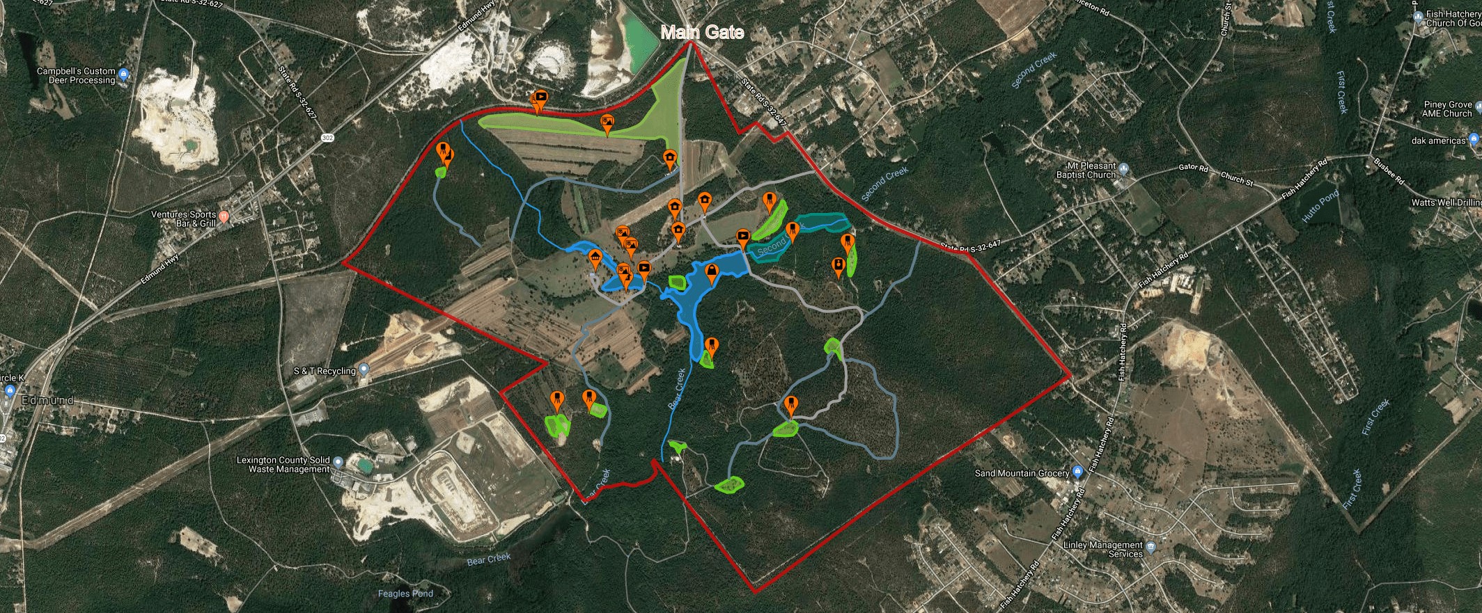
TerraStride Pro is an advanced, next-generation online mapping platform that helps brokers win and close more listings by improving how they map and market properties.
Brokers can use TerraStride Pro to make a complete map all the property's features. Prospective buyers can take interactive tours of these maps, browsing through uploaded media and grouped features, such as hunting assets and timber stands.
Compared to other mapping platforms, TerraStride Pro is easy to use and provides a robust toolset for creating and editing maps. It allows brokers to create media-rich maps for their listings in less than twenty minutes. The platform is completely online, and brokers can share maps simply by sharing their links. These engaging maps give buyers a better sense of the properties that brokers are selling.
TerraStride Pro helps brokers and buyers evaluate the most suitable listings before taking a trip to see them, which saves everyone a great deal of time and effort. This is especially helpful to brokers who are selling to clients in distant geographies.
Please visit TerraStridePro.com for more information.
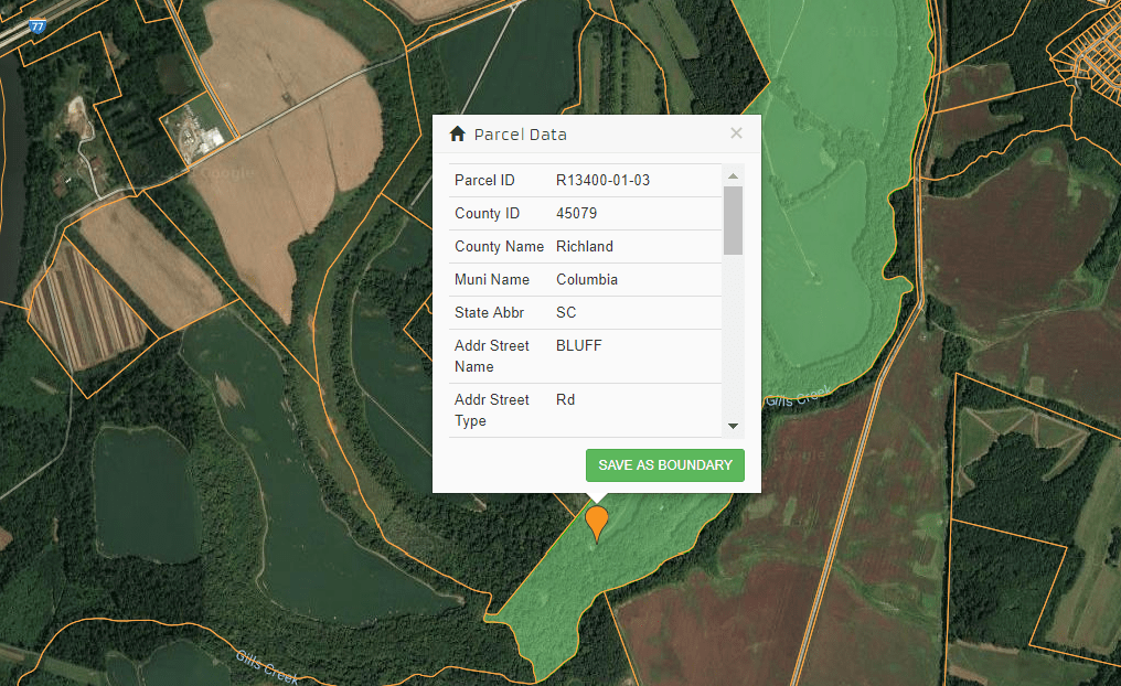
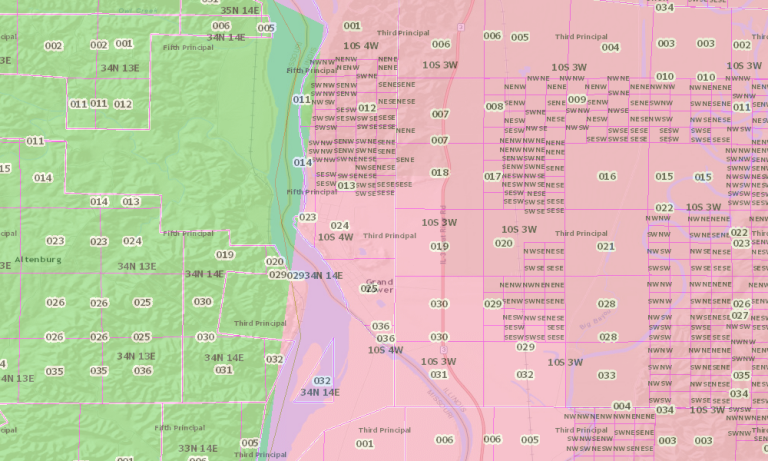
National Parcel Database
Access a complete parcel overlay map (shown above) and create accurate
property boundaries using a comprehensive national database. Gather
relevant meta data about a parcel, e.g., owner, market value, ids, etc.
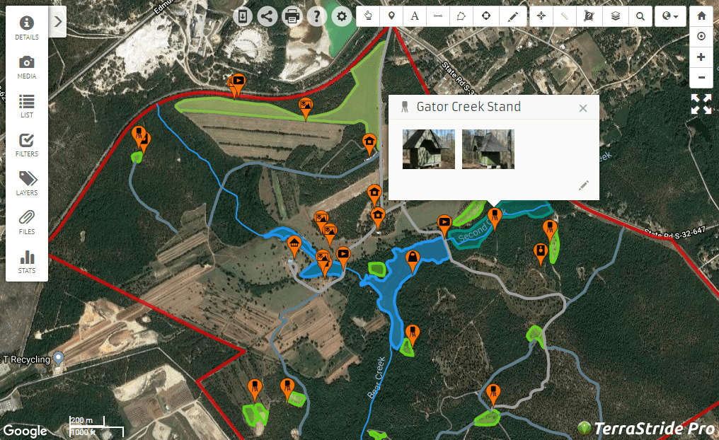
Annotation
Managing map objects is easy with TerraStride Pro. Annotate maps by
adding markers, lines, and polygons. Photos, videos and descriptions
can be added to any map object. Map objects can be organized in layers
that can be shown or hidden by default. Files can be attached to
any property.
Search
Search for properties by address, Section/Township/Range, Tax ID, or
Latitude/Longitude.
Printing
Print out detailed property maps complete with
legends and annotations.
Measurement
TerraStride Pro features tools for easily measuring distances and areas.
Advanced statistics are automatically computed for each property,
including: Deeded acreage, total acreage, timber, water, marsh, field,
or pasture area; total road, trail, or river length, and more.
Analytics
Track property views by location and frequency.
To explore TerraStride Pro for free go to TerraStridePro.com
Section/Township/Range layer and search tool
Soil Map
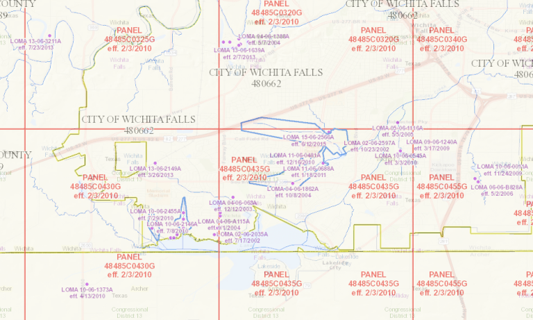
National Flood Hazard Layer
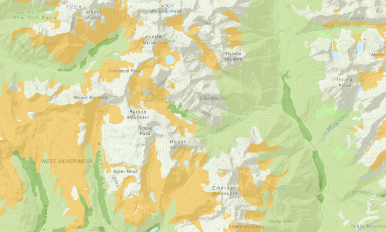
Topographical
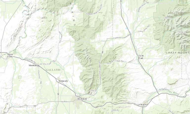
Federal/State lands, Government boundaries, Street Maps, and detailed Satellite Imagery
Try out TerraStride Pro for free at TerraStridePro.com


